
Narrawong topographic map
Interactive map
Click on the map to display elevation.
About this map
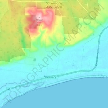
Name: Narrawong topographic map, elevation, terrain.
Average elevation: 45 m
Minimum elevation: -1 m
Maximum elevation: 187 m
Other topographic maps
Click on a map to view its topography, its elevation and its terrain.
Narrawong Coastal Reserve
Australia > Victoria > Narrawong
Narrawong Coastal Reserve, Narrawong, Shire of Glenelg, Victoria, 3285, Australia
Average elevation: 11 m