
Seaham topographic map
Interactive map
Click on the map to display elevation.
About this map
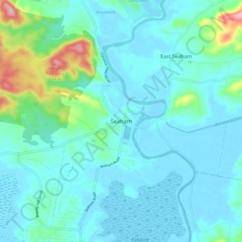
Name: Seaham topographic map, elevation, terrain.
Location: Seaham, Port Stephens Council, New South Wales, Australia (-32.70153 151.68677 -32.62153 151.76677)
Average elevation: 29 m
Minimum elevation: -2 m
Maximum elevation: 192 m
Other topographic maps
Click on a map to view its topography, its elevation and its terrain.
Seaham
Australia > New South Wales > Seaham
Seaham, Port Stephens Council, New South Wales, 2324, Australia
Average elevation: 29 m