
Bhaderwah topographic map
Interactive map
Click on the map to display elevation.
About this map
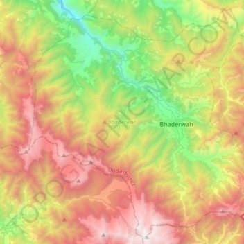
Name: Bhaderwah topographic map, elevation, terrain.
Location: Bhaderwah, Doda District, Jammu and Kashmir, 182222, India (32.86131 75.53895 33.09859 75.83532)
Average elevation: 2,511 m
Minimum elevation: 1,063 m
Maximum elevation: 4,330 m