
Weyburn topographic map
Interactive map
Click on the map to display elevation.
About this map
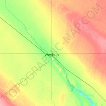
Name: Weyburn topographic map, elevation, terrain.
Average elevation: 585 m
Minimum elevation: 553 m
Maximum elevation: 625 m
Other topographic maps
Click on a map to view its topography, its elevation and its terrain.
Weyburn
Canada > Saskatchewan > Weyburn
Weyburn, Census Division No. 2, Saskatchewan, Canada
Average elevation: 571 m