
Lawson Creek topographic map
Interactive map
Click on the map to display elevation.
About this map
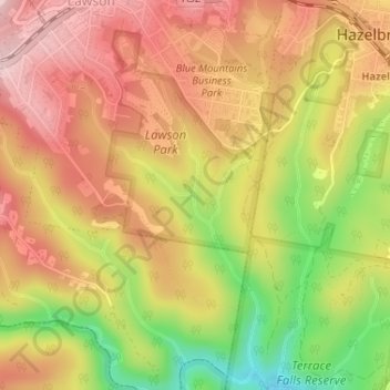
Name: Lawson Creek topographic map, elevation, terrain.
Average elevation: 643 m
Minimum elevation: 491 m
Maximum elevation: 748 m
Other topographic maps
Click on a map to view its topography, its elevation and its terrain.
Dantes Glen
Australia > New South Wales > Sydney > Lawson
Dantes Glen, Lawson, Sydney, Blue Mountains City Council, New South Wales, 2783, Australia
Average elevation: 689 m
Sydney Rock
Australia > New South Wales > Sydney > Lawson
Sydney Rock, Great Western Highway, Lawson, Sydney, Blue Mountains City Council, New South Wales, 2783, Australia
Average elevation: 671 m