
Saint Petersburg topographic map
Interactive map
Click on the map to display elevation.
About this map
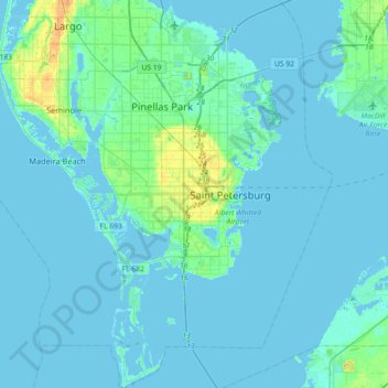
Name: Saint Petersburg topographic map, elevation, terrain.
Average elevation: 3 m
Minimum elevation: -2 m
Maximum elevation: 29 m
Other topographic maps
Click on a map to view its topography, its elevation and its terrain.
The Jungle
United States > Florida > Pinellas County > Saint Petersburg
The Jungle, Saint Petersburg, Pinellas County, Florida, 33744, United States
Average elevation: 5 m
Pasadena
United States > Florida > Pinellas County > Saint Petersburg
Pasadena, Saint Petersburg, Pinellas County, Florida, 33707, United States
Average elevation: 7 m
Meadowlawn Park
United States > Florida > Pinellas County > Saint Petersburg
Meadowlawn Park, Meadowlawn, Saint Petersburg, Pinellas County, Florida, United States
Average elevation: 5 m
Bayway Isles
United States > Florida > Pinellas County > Saint Petersburg
Bayway Isles, Saint Petersburg, Pinellas County, Florida, 33715, United States
Average elevation: 2 m