
宗嘎镇 topographic map
Interactive map
Click on the map to display elevation.
About this map
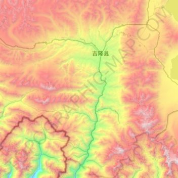
Name: 宗嘎镇 topographic map, elevation, terrain.
Location: 宗嘎镇, Gyirong County, Shigatse, Tibet, China (28.51711 84.95037 28.99847 85.43652)
Average elevation: 4,978 m
Minimum elevation: 3,238 m
Maximum elevation: 6,851 m