
Harden topographic map
Interactive map
Click on the map to display elevation.
About this map
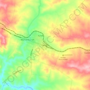
Name: Harden topographic map, elevation, terrain.
Location: Harden, Hilltops Council, New South Wales, 2587, Australia (-34.59400 148.32904 -34.51400 148.40904)
Average elevation: 425 m
Minimum elevation: 337 m
Maximum elevation: 511 m
New South Wales trails, hiking, mountain biking, running and outdoor activities