
Mundubbera topographic map
Interactive map
Click on the map to display elevation.
About this map
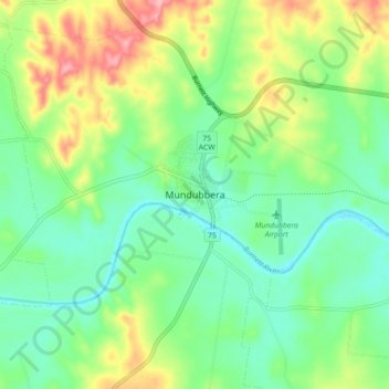
Name: Mundubbera topographic map, elevation, terrain.
Location: Mundubbera, North Burnett Regional, Queensland, Australia (-25.63097 151.25943 -25.55097 151.33943)
Average elevation: 146 m
Minimum elevation: 104 m
Maximum elevation: 227 m