
Moshi topographic map
Interactive map
Click on the map to display elevation.
Moshi
Moshi's lower altitude and drier climate mean that the main crops grown on the higher slopes of Mt Kilimanjaro, coffee and bananas, do not thrive there. The surrounding areas in Moshi district are known for extensive farms of maize and beans, grown once per year during the long rainy season (known as "masika" in Kiswahili). In addition, the Tanganyika Planting Company operates a very large sugar cane plantation and company town 20 kilometres (12 mi) south of Moshi.
About this map
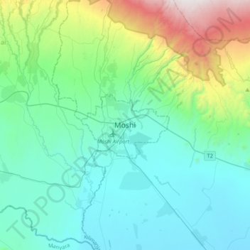
Name: Moshi topographic map, elevation, terrain.
Average elevation: 1,109 m
Minimum elevation: 699 m
Maximum elevation: 2,794 m
Other topographic maps
Click on a map to view its topography, its elevation and its terrain.