
London Borough of Croydon topographic map
Interactive map
Click on the map to display elevation.
About this map
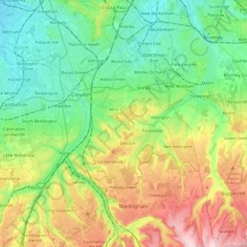
Name: London Borough of Croydon topographic map, elevation, terrain.
Average elevation: 102 m
Minimum elevation: 16 m
Maximum elevation: 260 m