
Osmond topographic map
Interactive map
Click on the map to display elevation.
About this map
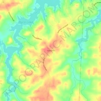
Name: Osmond topographic map, elevation, terrain.
Location: Osmond, Caswell County, North Carolina, 27291, USA (36.42708 -79.17835 36.46708 -79.13835)
Average elevation: 148 m
Minimum elevation: 120 m
Maximum elevation: 177 m