
London Borough of Hounslow topographic map
Interactive map
Click on the map to display elevation.
About this map
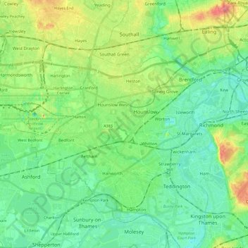
Name: London Borough of Hounslow topographic map, elevation, terrain.
Average elevation: 21 m
Minimum elevation: 0 m
Maximum elevation: 70 m
Other topographic maps
Click on a map to view its topography, its elevation and its terrain.
Brentford
United Kingdom > England > London Borough of Hounslow > Brentford
Brentford, London Borough of Hounslow, England, TW8 9DE, United Kingdom
Average elevation: 22 m