
La Trinité topographic map
Interactive map
Click on the map to display elevation.
About this map
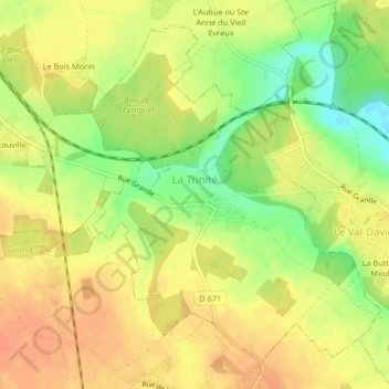
Name: La Trinité topographic map, elevation, terrain.
Average elevation: 131 m
Minimum elevation: 106 m
Maximum elevation: 145 m
Other topographic maps
Click on a map to view its topography, its elevation and its terrain.
Saint-Germain-des-Angles
France > Normandy > Eure > Saint-Germain-des-Angles
Saint-Germain-des-Angles, Évreux, Eure, Normandy, Metropolitan France, 27930, France
Average elevation: 100 m
Mandeville
Mandeville, Bernay, Eure, Normandy, Metropolitan France, 27370, France
Average elevation: 157 m