
Lutana topographic map
Interactive map
Click on the map to display elevation.
About this map
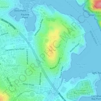
Name: Lutana topographic map, elevation, terrain.
Location: Lutana, Hobart, City of Glenorchy, Tasmania, Australia (-42.84967 147.30332 -42.82838 147.32368)
Average elevation: 17 m
Minimum elevation: -2 m
Maximum elevation: 108 m
Tasmania trails, hiking, mountain biking, running and outdoor activities
Other topographic maps
Click on a map to view its topography, its elevation and its terrain.