
Maungapōhatu topographic map
Interactive map
Click on the map to display elevation.
About this map
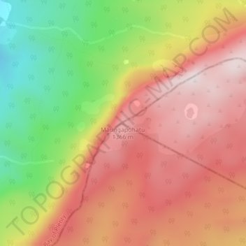
Name: Maungapōhatu topographic map, elevation, terrain.
Location: Maungapōhatu, Gisborne District, Gisborne, New Zealand (-38.58393 177.12231 -38.58383 177.12241)
Average elevation: 1,070 m
Minimum elevation: 680 m
Maximum elevation: 1,363 m
Other topographic maps
Click on a map to view its topography, its elevation and its terrain.