
Skipton topographic map
Interactive map
Click on the map to display elevation.
About this map
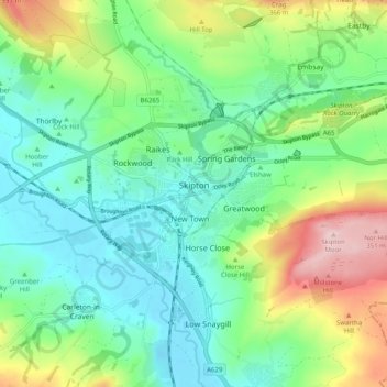
Name: Skipton topographic map, elevation, terrain.
Average elevation: 173 m
Minimum elevation: 89 m
Maximum elevation: 367 m
Other topographic maps
Click on a map to view its topography, its elevation and its terrain.
Hunter Hill
United Kingdom > England > North Yorkshire > Craven District
Hunter Hill, Craven District, North Yorkshire, England, BD24 0JB, United Kingdom
Average elevation: 312 m