
Onslow topographic map
Interactive map
Click on the map to display elevation.
About this map
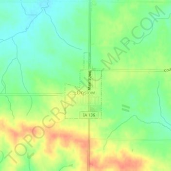
Name: Onslow topographic map, elevation, terrain.
Location: Onslow, Jones County, Iowa, United States (42.10279 -91.01960 42.11321 -91.01183)
Average elevation: 277 m
Minimum elevation: 256 m
Maximum elevation: 302 m
Other topographic maps
Click on a map to view its topography, its elevation and its terrain.