
Oberursel topographic map
Interactive map
Click on the map to display elevation.
About this map
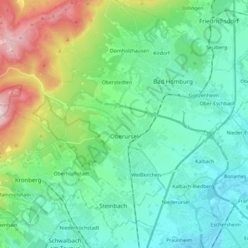
Name: Oberursel topographic map, elevation, terrain.
Location: Oberursel, Hochtaunuskreis, Hesse, 61440, Germany (50.16730 8.45345 50.24523 8.63876)
Average elevation: 248 m
Minimum elevation: 99 m
Maximum elevation: 728 m