
Sylvania topographic map
Interactive map
Click on the map to display elevation.
About this map
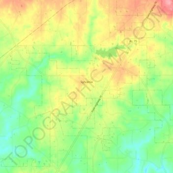
Name: Sylvania topographic map, elevation, terrain.
Location: Sylvania, DeKalb County, Alabama, 35988, United States (34.52887 -85.85662 34.59101 -85.75470)
Average elevation: 405 m
Minimum elevation: 359 m
Maximum elevation: 462 m
Other topographic maps
Click on a map to view its topography, its elevation and its terrain.