
Thank you for supporting this site ❤️
Make a donation
Make a donation
Gear up for your next adventure:
As an Amazon Associate, this site earns from qualifying purchases at no extra cost to you.
Nashua topographic map
Click on the map to display elevation.
Thank you for supporting this site ❤️
Make a donation
Make a donation
Gear up for your next adventure:
As an Amazon Associate, this site earns from qualifying purchases at no extra cost to you.
About this map
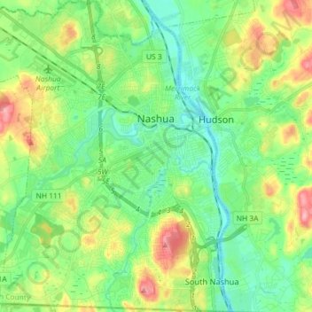
Name: Nashua topographic map, elevation, terrain.
Location: Nashua, Hillsborough County, New Hampshire, United States (42.69987 -71.56139 42.80586 -71.43229)
Average elevation: 62 m
Minimum elevation: 26 m
Maximum elevation: 135 m
Thank you for supporting this site ❤️
Make a donation
Make a donation
Gear up for your next adventure:
As an Amazon Associate, this site earns from qualifying purchases at no extra cost to you.
Other topographic maps
Click on a map to view its topography, its elevation and its terrain.
Thorntons Ferry
United States > New Hampshire > Hillsborough County > Merrimack
Average elevation: 54 m