
Quilotoa topographic map
Interactive map
Click on the map to display elevation.
About this map
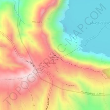
Name: Quilotoa topographic map, elevation, terrain.
Location: Quilotoa, Chugchillan, Sigchos, Cotopaxi, 050456, Ecuador (-0.86725 -78.91530 -0.86715 -78.91520)
Average elevation: 3,721 m
Minimum elevation: 3,484 m
Maximum elevation: 3,937 m
Quilotoa is a tourist site of growing popularity. The route to the "summit" (the small town of Quilotoa) is generally traveled by hired truck or bus from the town of Zumbahua 17 km to the South, or more commonly by bus from Latacunga. Visitors no longer have to pay two US dollars each to look from the lip of the caldera. There are a number of simple hostels in the immediate area offering services such as mules and guides. Activities include a four to five-hour hike around the caldera (whose diameter is just over 3 km). The caldera rim is highly irregular and reaches its maximum elevations (3810 m to the N, 3894 m to the NW and 3915 m to the SE) at three lava domes. The 10 km hike is sandy and steep in places and can be quite taxing, particularly if there is fog.