
Ararat Province topographic map
Interactive map
Click on the map to display elevation.
About this map
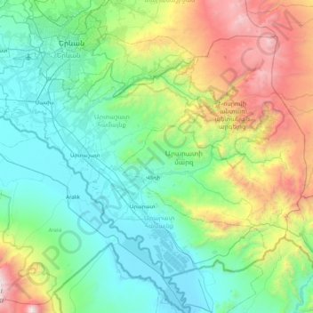
Name: Ararat Province topographic map, elevation, terrain.
Location: Ararat Province, Armenia (39.71388 44.31613 40.19180 45.11717)
Average elevation: 1,440 m
Minimum elevation: 796 m
Maximum elevation: 5,100 m