
Miller County topographic map
Interactive map
Click on the map to display elevation.
About this map
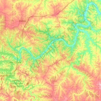
Name: Miller County topographic map, elevation, terrain.
Location: Miller County, Missouri, United States (38.02128 -92.69589 38.43496 -92.18058)
Average elevation: 240 m
Minimum elevation: 162 m
Maximum elevation: 354 m
Other topographic maps
Click on a map to view its topography, its elevation and its terrain.
Lake Ozark
United States > Missouri > Miller County > Lake Ozark
Lake Ozark, Miller County, Missouri, United States
Average elevation: 213 m