
Highland Park topographic map
Interactive map
Click on the map to display elevation.
About this map
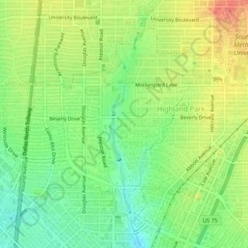
Name: Highland Park topographic map, elevation, terrain.
Location: Highland Park, Dallas County, Texas, 75205, United States (32.81894 -96.81922 32.84391 -96.78093)
Average elevation: 165 m
Minimum elevation: 141 m
Maximum elevation: 192 m
Other topographic maps
Click on a map to view its topography, its elevation and its terrain.
Garland
United States > Texas > Dallas County
Garland, Dallas County, Texas, United States
Average elevation: 165 m
Dallas
United States > Texas > Dallas County > Dallas
Dallas, Dallas County, Texas, 75242, United States
Average elevation: 158 m