
Tenby topographic map
Interactive map
Click on the map to display elevation.
About this map
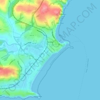
Name: Tenby topographic map, elevation, terrain.
Location: Tenby, Pembrokeshire, Wales, United Kingdom (51.65116 -4.72679 51.68814 -4.69092)
Average elevation: 15 m
Minimum elevation: 0 m
Maximum elevation: 94 m