
Ban Bueng topographic map
Interactive map
Click on the map to display elevation.
About this map
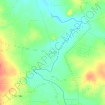
Name: Ban Bueng topographic map, elevation, terrain.
Location: Ban Bueng, Ratchaburi Province, 70180, Thailand (13.43060 99.37859 13.47060 99.41859)
Average elevation: 156 m
Minimum elevation: 132 m
Maximum elevation: 193 m