
Thank you for supporting this site ❤️
Make a donation
Make a donation
Gear up for your next adventure:
As an Amazon Associate, this site earns from qualifying purchases at no extra cost to you.
Nirranda topographic map
Click on the map to display elevation.
Thank you for supporting this site ❤️
Make a donation
Make a donation
Gear up for your next adventure:
As an Amazon Associate, this site earns from qualifying purchases at no extra cost to you.
About this map
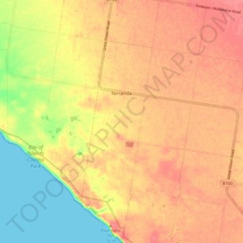
Name: Nirranda topographic map, elevation, terrain.
Location: Nirranda, Shire of Moyne, Victoria, 3268, Australia (-38.54555 142.73735 -38.47147 142.81109)
Average elevation: 43 m
Minimum elevation: 0 m
Maximum elevation: 68 m
Victoria trails, hiking, mountain biking, running and outdoor activities
Thank you for supporting this site ❤️
Make a donation
Make a donation
Gear up for your next adventure:
As an Amazon Associate, this site earns from qualifying purchases at no extra cost to you.