
Thank you for supporting this site ❤️
Make a donation
Make a donation
Gear up for your next adventure:
As an Amazon Associate, this site earns from qualifying purchases at no extra cost to you.
Börringe topographic map
Click on the map to display elevation.
Thank you for supporting this site ❤️
Make a donation
Make a donation
Gear up for your next adventure:
As an Amazon Associate, this site earns from qualifying purchases at no extra cost to you.
About this map
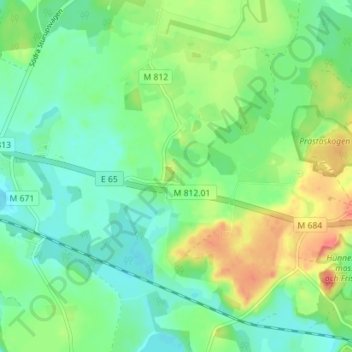
Name: Börringe topographic map, elevation, terrain.
Location: Börringe, Svedala kommun, Skåne County, 23391, Sweden (55.48554 13.34120 55.52554 13.38120)
Average elevation: 65 m
Minimum elevation: 46 m
Maximum elevation: 99 m
Thank you for supporting this site ❤️
Make a donation
Make a donation
Gear up for your next adventure:
As an Amazon Associate, this site earns from qualifying purchases at no extra cost to you.