
Kamonyi topographic map
Interactive map
Click on the map to display elevation.
About this map
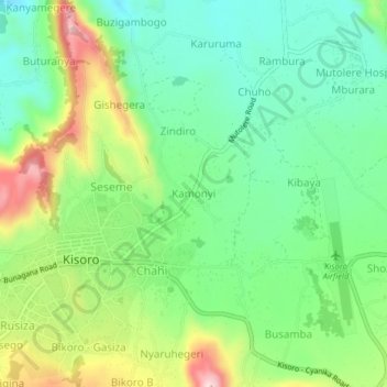
Name: Kamonyi topographic map, elevation, terrain.
Location: Kamonyi, Cyanika, Kisoro, Western Region, PO BOX 22, Uganda (-1.29536 29.68434 -1.25536 29.72434)
Average elevation: 1,898 m
Minimum elevation: 1,791 m
Maximum elevation: 2,097 m