
Esterri de Aneu topographic map
Interactive map
Click on the map to display elevation.
About this map
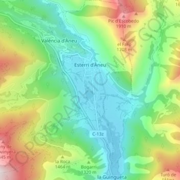
Name: Esterri de Aneu topographic map, elevation, terrain.
Location: Esterri de Aneu, Pallars Sobirá, Lérida, Cataluña, 25580, España (42.59454 1.08082 42.64579 1.13923)
Average elevation: 1,297 m
Minimum elevation: 933 m
Maximum elevation: 2,050 m