
Church Road topographic map
Interactive map
Click on the map to display elevation.
About this map
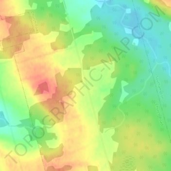
Name: Church Road topographic map, elevation, terrain.
Location: Church Road, Kings County, Prince Edward Island, Canada (46.36362 -62.63148 46.38362 -62.61148)
Average elevation: 34 m
Minimum elevation: 5 m
Maximum elevation: 63 m
Other topographic maps
Click on a map to view its topography, its elevation and its terrain.
North Lake
Canada > Prince Edward Island > Rural Municipality of Eastern Kings
Average elevation: 14 m
Greenmount
Canada > Prince Edward Island > Rural Municipality of Greenmount-Montrose
Average elevation: 19 m
Prince Edward Island National Park
Canada > Prince Edward Island > Lot 24 > Rustico
Average elevation: 15 m