
Barca topographic map
Interactive map
Click on the map to display elevation.
About this map
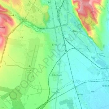
Name: Barca topographic map, elevation, terrain.
Average elevation: 218 m
Minimum elevation: 179 m
Maximum elevation: 311 m
Other topographic maps
Click on a map to view its topography, its elevation and its terrain.
District of Košice IV
Slovakia > Region of Košice > District of Košice IV
District of Košice IV, Košice, Region of Košice, Eastern Slovakia, Slovakia
Average elevation: 223 m