
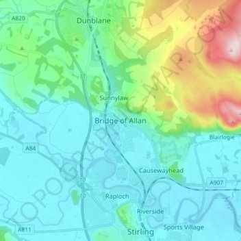
Bridge of Allan topographic map
Interactive map
Click on the map to display elevation.
About this map
Name: Bridge of Allan topographic map, elevation, terrain.
Location: Bridge of Allan, Stirling, Scotland, FK9 4HW, United Kingdom (56.11504 -3.98807 56.19504 -3.90807)
Average elevation: 80 m
Minimum elevation: -1 m
Maximum elevation: 416 m
Other topographic maps
Click on a map to view its topography, its elevation and its terrain.
Killearn
United Kingdom > Scotland > Stirling > Killearn
Killearn, Stirling, Scotland, G63 9NH, United Kingdom
Average elevation: 82 m
Drymen
United Kingdom > Scotland > Stirling
Drymen, Stirling, Scotland, G63 0BJ, United Kingdom
Average elevation: 59 m
Aberfoyle
United Kingdom > Scotland > Stirling
Aberfoyle, Stirling, Scotland, FK8 3UH, United Kingdom
Average elevation: 129 m