
Murrieta topographic map
Interactive map
Click on the map to display elevation.
About this map
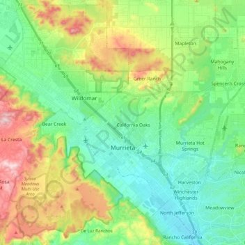
Name: Murrieta topographic map, elevation, terrain.
Location: Murrieta, Riverside County, California, United States (33.51343 -117.28004 33.64182 -117.08420)
Average elevation: 454 m
Minimum elevation: 305 m
Maximum elevation: 782 m
Other topographic maps
Click on a map to view its topography, its elevation and its terrain.
Lake Elsinore
United States > California > Riverside County > Lake Elsinore > Lake Elsinore
Average elevation: 428 m