
Rochester topographic map
Interactive map
Click on the map to display elevation.
About this map
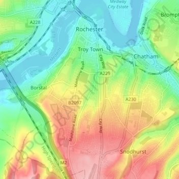
Name: Rochester topographic map, elevation, terrain.
Location: Rochester, South East, England, United Kingdom (51.35263 0.45620 51.39529 0.51764)
Average elevation: 51 m
Minimum elevation: 0 m
Maximum elevation: 125 m