
Chidlow topographic map
Interactive map
Click on the map to display elevation.
About this map
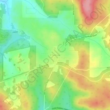
Name: Chidlow topographic map, elevation, terrain.
Location: Chidlow, Western Australia, 6556, Australia (-31.87960 116.24874 -31.83960 116.28874)
Average elevation: 295 m
Minimum elevation: 242 m
Maximum elevation: 360 m
Other topographic maps
Click on a map to view its topography, its elevation and its terrain.
Lake Leschenaultia
Australia > Western Australia > Chidlow
Lake Leschenaultia, Chidlow, Shire Of Mundaring, Western Australia, Australia
Average elevation: 280 m