
Vrhnika topographic map
Interactive map
Click on the map to display elevation.
About this map
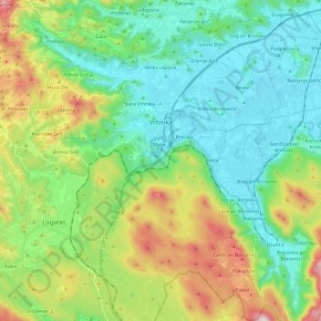
Name: Vrhnika topographic map, elevation, terrain.
Location: Vrhnika, Upravna Enota Vrhnika, Osrednjeslovenska, Slovenia (45.86951 14.18861 46.02566 14.38315)
Average elevation: 479 m
Minimum elevation: 280 m
Maximum elevation: 969 m