
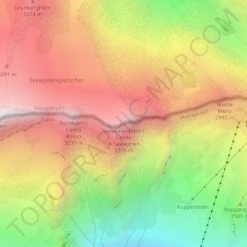
Seewjinenhorn / Corno di Seewjinen topographic map
Interactive map
Click on the map to display elevation.
About this map
Name: Seewjinenhorn / Corno di Seewjinen topographic map, elevation, terrain.
Average elevation: 2,694 m
Minimum elevation: 1,972 m
Maximum elevation: 3,302 m
Other topographic maps
Click on a map to view its topography, its elevation and its terrain.
Strahlhorn
Switzerland > Valais/Wallis > Saas-Almagell
Strahlhorn, Saas-Almagell, Visp, Valais/Wallis, 3905, Switzerland
Average elevation: 3,581 m