
Gemeinde Leobendorf topographic map
Interactive map
Click on the map to display elevation.
About this map
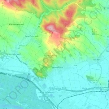
Name: Gemeinde Leobendorf topographic map, elevation, terrain.
Average elevation: 205 m
Minimum elevation: 157 m
Maximum elevation: 355 m
Other topographic maps
Click on a map to view its topography, its elevation and its terrain.
Leobendorf
Österreich > Niederösterreich > Gemeinde Leobendorf > Leobendorf
Leobendorf, Gemeinde Leobendorf, Bezirk Korneuburg, Niederösterreich, 2199, Österreich
Average elevation: 197 m