
Daisy Hill topographic map
Interactive map
Click on the map to display elevation.
About this map
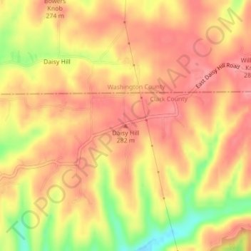
Name: Daisy Hill topographic map, elevation, terrain.
Location: Daisy Hill, Clark County, Indiana, USA (38.49918 -85.93002 38.49928 -85.92992)
Average elevation: 264 m
Minimum elevation: 205 m
Maximum elevation: 291 m
Other topographic maps
Click on a map to view its topography, its elevation and its terrain.