
Raanana topographic map
Interactive map
Click on the map to display elevation.
About this map
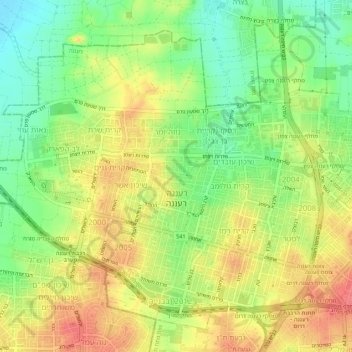
Name: Raanana topographic map, elevation, terrain.
Location: Raanana, Petah Tikva Subdistrict, Center District, Israel (32.16968 34.83677 32.20969 34.89126)
Average elevation: 49 m
Minimum elevation: 16 m
Maximum elevation: 81 m
Other topographic maps
Click on a map to view its topography, its elevation and its terrain.