
Isfjorden topographic map
Interactive map
Click on the map to display elevation.
About this map
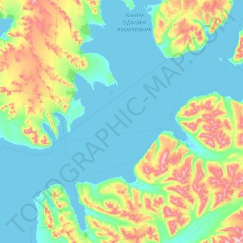
Name: Isfjorden topographic map, elevation, terrain.
Location: Isfjorden, Svalbard, Norway (78.04914 12.98589 78.50210 16.39754)
Average elevation: 186 m
Minimum elevation: -2 m
Maximum elevation: 1,213 m
Other topographic maps
Click on a map to view its topography, its elevation and its terrain.