
Runaway Bay topographic map
Interactive map
Click on the map to display elevation.
About this map
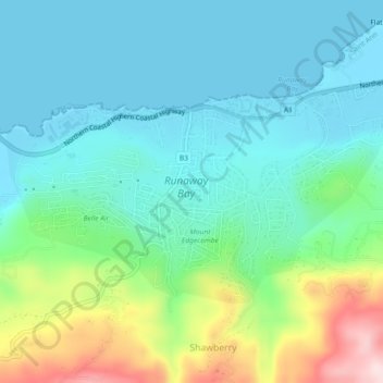
Name: Runaway Bay topographic map, elevation, terrain.
Location: Runaway Bay, Saint Ann, Middlesex County, Jamaica (18.44125 -77.35741 18.46644 -77.31183)
Average elevation: 86 m
Minimum elevation: 0 m
Maximum elevation: 349 m