
Hastings Point topographic map
Interactive map
Click on the map to display elevation.
About this map
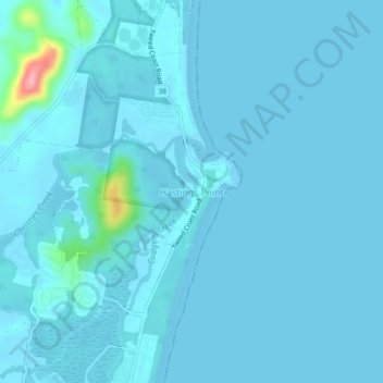
Name: Hastings Point topographic map, elevation, terrain.
Average elevation: 7 m
Minimum elevation: -1 m
Maximum elevation: 122 m
Other topographic maps
Click on a map to view its topography, its elevation and its terrain.
Cudgera Creek
Australia > New South Wales > Hastings Point
Cudgera Creek, Hastings Point, Tweed Shire Council, New South Wales, 2489, Australia
Average elevation: 7 m