
Schluppes topographic map
Interactive map
Click on the map to display elevation.
About this map
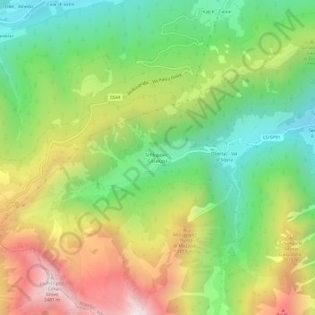
Name: Schluppes topographic map, elevation, terrain.
Location: Schluppes, Wipptal, Bozen, Trentino-Südtirol, Italien (46.82949 11.33401 46.86949 11.37401)
Average elevation: 1,718 m
Minimum elevation: 1,172 m
Maximum elevation: 2,484 m