
Rawson topographic map
Interactive map
Click on the map to display elevation.
About this map
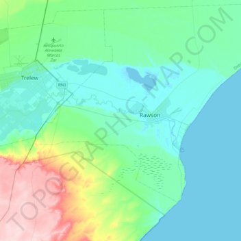
Name: Rawson topographic map, elevation, terrain.
Location: Rawson, Departamento Rawson, CHB, Argentina (-43.40699 -65.30985 -43.20482 -64.90167)
Average elevation: 43 m
Minimum elevation: -1 m
Maximum elevation: 214 m
Other topographic maps
Click on a map to view its topography, its elevation and its terrain.