
George Brown Darwin Botanic Gardens topographic map
Interactive map
Click on the map to display elevation.
About this map
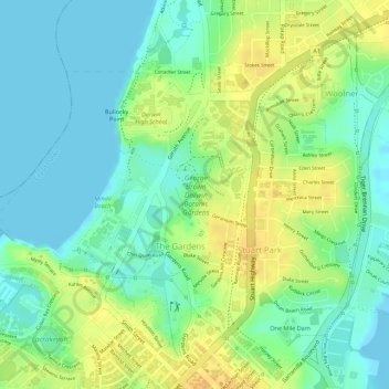
Name: George Brown Darwin Botanic Gardens topographic map, elevation, terrain.
Average elevation: 14 m
Minimum elevation: -1 m
Maximum elevation: 30 m
Other topographic maps
Click on a map to view its topography, its elevation and its terrain.
Charles Darwin National Park
Australia > Northern Territory > Darwin
Charles Darwin National Park, Hidden Valley, Darwin, City of Darwin, Northern Territory, 0800, Australia
Average elevation: 13 m