
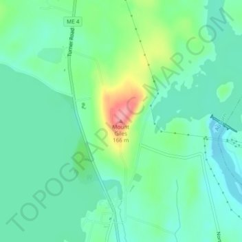
Mount Giles topographic map
Interactive map
Click on the map to display elevation.
About this map
Name: Mount Giles topographic map, elevation, terrain.
Average elevation: 87 m
Minimum elevation: 59 m
Maximum elevation: 161 m
Other topographic maps
Click on a map to view its topography, its elevation and its terrain.
Bird Poop Island
United States > Maine > Androscoggin County > Auburn
Bird Poop Island, Auburn, Androscoggin County, Maine, 04210, United States
Average elevation: 87 m