
Arkansas River topographic map
Interactive map
Click on the map to display elevation.
About this map
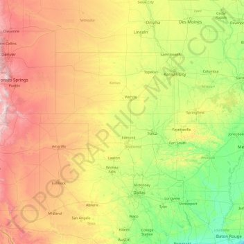
Name: Arkansas River topographic map, elevation, terrain.
Location: Arkansas River, Reno County, Kansas, 67119, USA (33.76625 -106.35703 39.25837 -91.08811)
Average elevation: 634 m
Minimum elevation: 0 m
Maximum elevation: 4,110 m
Other topographic maps
Click on a map to view its topography, its elevation and its terrain.